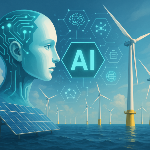
Offshore wind holds immense potential to supply clean electricity at gigawatt scale – but siting these massive projects is anything but simple. Developers must consider wind resource availability, seabed conditions, environmental impact, marine traffic, grid proximity, and more – across dynamic and often data-scarce ocean zones.
That’s where Artificial Intelligence (AI) comes in. By analyzing multi-layered geospatial data and simulating site trade-offs in real time, AI enables faster, more accurate, and more sustainable offshore wind siting decisions.
In this post, we explore how AI is transforming the early-stage planning and siting of offshore wind projects – reducing risk, compressing timelines, and maximizing energy yield.
📚 Table of Contents
- AI-Enhanced Site Selection for Offshore Wind
– 1.1 High-Resolution Geospatial Suitability Mapping
– 1.2 Wind Resource Forecasting and Yield Prediction
– 1.3 AI for Environmental Impact Analysis
– 1.4 Grid Proximity and Infrastructure Assessment - Challenges in Offshore Wind Siting—and How AI Solves Them
– 2.1 Massive, Disparate Datasets
– 2.2 Sparse Wind Data in Ocean Zones
– 2.3 Regulatory and Ecological Constraints
– 2.4 Seabed Variability and Foundation Uncertainty - Core AI Tools and Technologies
- Real-World Impact: Case Studies
- AI Startups & Platforms to Watch
- Final Thoughts
⚙️ AI-Enhanced Site Selection for Offshore Wind
1. High-Resolution Geospatial Suitability Mapping
AI platforms integrate layers of data including:


 Our specialty focus areas include

Net Zero by Narsi
Insights and interactions on climate action by Narasimhan Santhanam, Director - EAI
View full playlist- Bathymetry and seabed composition
- Marine traffic and shipping lanes
- Biodiversity zones and protected habitats
- Grid access points, ports, and cable routes
Machine learning models synthesize this into multi-criteria suitability maps, helping developers identify optimal project zones quickly and confidently.
2. Wind Resource Forecasting and Yield Prediction
AI improves long-term wind modeling by:
- Ingesting satellite data, weather reanalyses, and mesoscale simulations
- Using deep learning to estimate wind speed and turbulence at hub height
- Providing bankable energy yield estimates with higher spatial resolution and less uncertainty
3. AI for Environmental Impact Analysis
AI helps avoid costly permitting delays by:
- Detecting marine species migration paths using computer vision on drone and satellite imagery
- Mapping sensitive habitats with multispectral sensors
- Identifying low-conflict development zones that align with sustainability goals
4. Grid Proximity and Infrastructure Assessment
Beyond wind strength, grid access matters. AI evaluates:
- Distance to substations and ports
- Seabed trenching feasibility for cables
- Construction vessel accessibility and sea state history
This helps optimize energy delivery costs and infrastructure planning.
🛠️ Challenges in Offshore Wind Siting—And How AI Solves Them
✅ Challenge 1: Fragmented and High-Volume Geospatial Data
Siting involves vast datasets with differing formats, accuracy, and timeframes. AI:
- Fuses GIS, sensor, marine, and regulatory data
- Performs automated trade-off analysis
- Visualizes siting decisions in interactive dashboards
✅ Challenge 2: Sparse or Unreliable Wind Data Offshore
With limited LIDAR or meteorological masts at sea, accurate wind estimates are tough. AI:
- Uses physics-informed ML to enhance sparse datasets
- Predicts wind shear, turbulence, and seasonal variation
- Reduces uncertainty in yield forecasts
✅ Challenge 3: Environmental and Permitting Risk
Protected areas, naval routes, and fisheries often delay projects. AI:
- Models environmental trade-offs in early stages
- Flags likely permitting obstacles before site selection
- Enables smoother stakeholder engagement
✅ Challenge 4: Seabed and Foundation Suitability Uncertainty
Geophysical surveys are expensive and time-consuming. AI:
- Interpolates seabed conditions using sonar and past survey data
- Predicts soil layers and foundation compatibility
- Reduces reliance on exploratory drilling
🤖 Core AI Tools and Technologies
| AI Technology | Application Area |
|---|---|
| Geospatial AI + GIS Integration | Layering spatial, environmental, and logistical data for siting |
| Deep Learning for Wind Estimation | Accurate hub-height wind and turbulence prediction |
| Multi-Objective Optimization | Balancing yield, cost, impact, and regulatory criteria |
| Computer Vision + Remote Sensing | Identifying sensitive marine ecosystems and vessel lanes |
| Physics-Informed ML | Enhancing predictions in data-sparse offshore regions |
📈 Real-World Impact: Case Studies
Fraunhofer IWES (Germany)
Applied ML for bathymetric interpolation and turbine spacing optimization in offshore auctions—cutting analysis time by 50%.
Orsted + IBM Research
Used AI to accelerate environmental assessments and classify seabed types in UK wind leasing rounds.
NREL (USA)
Developed an AI-based spatial planning platform to identify gigawatt-scale offshore potential with low ecological disruption.
🚀 AI Startups & Platforms to Watch
| Company | TRL | What They Do |
|---|---|---|
| Kinewell Energy | TRL 8–9 | AI for offshore cable routing and optimal infrastructure layout planning |
| OceanMind | TRL 7 | AI platform for marine biodiversity tracking and permitting risk assessment |
🌊 Final Thoughts
Choosing where to place an offshore wind farm is a billion-dollar decision—with consequences for grid access, environmental impact, project timelines, and long-term energy yield. AI is now the decisive advantage.
By unifying data, accelerating analysis, and enhancing prediction accuracy, AI helps developers site offshore wind faster, smarter, and with fewer surprises.
As offshore wind scales globally, digital intelligence will be essential to unlock high-yield zones while protecting ocean ecosystems and managing infrastructure complexity.
💡 Want More?
Follow us for more insights into how AI is driving smarter renewable energy planning—from siting to dispatch to decommissioning.