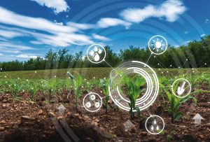
Healthy soil is the foundation of productive agriculture, but traditional soil testing is slow, costly, and limited in scope. Artificial Intelligence is unlocking real-time, high-resolution insights from satellites, drones, and IoT sensors, giving farmers the power to manage soil health with precision and scale like never before.
🎯 How AI Can Make This Product or Solution Much Better
🗺 High-Resolution Soil Mapping
AI fuses satellite imagery, hyperspectral drone scans, and proximal sensing to produce soil maps at sub-meter resolution.
This reveals fine-scale variability in moisture, nutrients, pH, and organic matter without extensive manual sampling.
📡 Real-Time Soil Health Monitoring
Machine learning models analyze continuous multi-sensor data to detect fertility changes, compaction, and salinity in real time.
This enables rapid responses to emerging soil health issues before they impact yields.
🔮 Predictive Soil Condition Modeling
AI forecasts soil property shifts based on climate patterns, crop rotations, and field management practices.
Farmers can act proactively to prevent degradation and optimize inputs.


 Our specialty focus areas include

Net Zero by Narsi
Insights and interactions on climate action by Narasimhan Santhanam, Director - EAI
View full playlist⚙ Integration with Precision Farming Systems
Remote sensing data feeds directly into Variable Rate Application (VRA) tools for fertilizer, lime, and irrigation – maximizing efficiency while cutting waste.
🌱 Carbon Sequestration Tracking
AI quantifies changes in soil organic carbon stocks, enabling farms to participate in carbon credit markets and meet sustainability targets.
🛠️ How AI Overcomes Key Challenges
| Challenge | AI Solution |
|---|---|
| High cost & labor of traditional sampling | Remote sensing + minimal calibration sampling reduces cost and increases coverage |
| Limited frequency of soil testing | Continuous monitoring from satellites/drones speeds up decision-making |
| Complex spatial variability | AI processes multi-layer data to produce site-specific soil maps |
| Raw data not translating to action | AI-driven DSS converts soil insights into precise field management plans |
🤖 Main AI Tools and Concepts Used
- CNNs for hyperspectral image classification
- Random Forests & Gradient Boosting for soil property prediction
- Multi-sensor fusion from satellites, drones, and IoT devices
- Digital twins of soil systems for scenario simulation
- Geostatistical AI models for spatial variability mapping
📊 Case Studies
- SoilOptix (Canada) – AI-powered gamma radiation mapping generates ultra-high-resolution soil maps for nutrient management.
- Gamaya (Switzerland) – Drone-based hyperspectral imaging with AI analytics for organic matter and nutrient mapping.
- CropX (Israel) – Combines IoT soil probes with satellite data for irrigation and fertilization recommendations.
🚀 Relevant Startups & Providers
| Company | Focus |
|---|---|
| SoilOptix (Canada) | AI + gamma sensing for ultra-high-resolution soil property maps |
| Gamaya (Switzerland) | Hyperspectral imaging + AI for soil nutrient and organic matter mapping |
| CropX (Israel) | Remote + in-situ AI soil analytics for irrigation and fertilizer planning |
💡 Want More?
Follow us for more insights on how AI is transforming agriculture, from mapping soil at the sub-meter level to predicting its health decades into the future, empowering farmers to boost yields while regenerating the land.