This is a part of the EV Digital Opportunities series
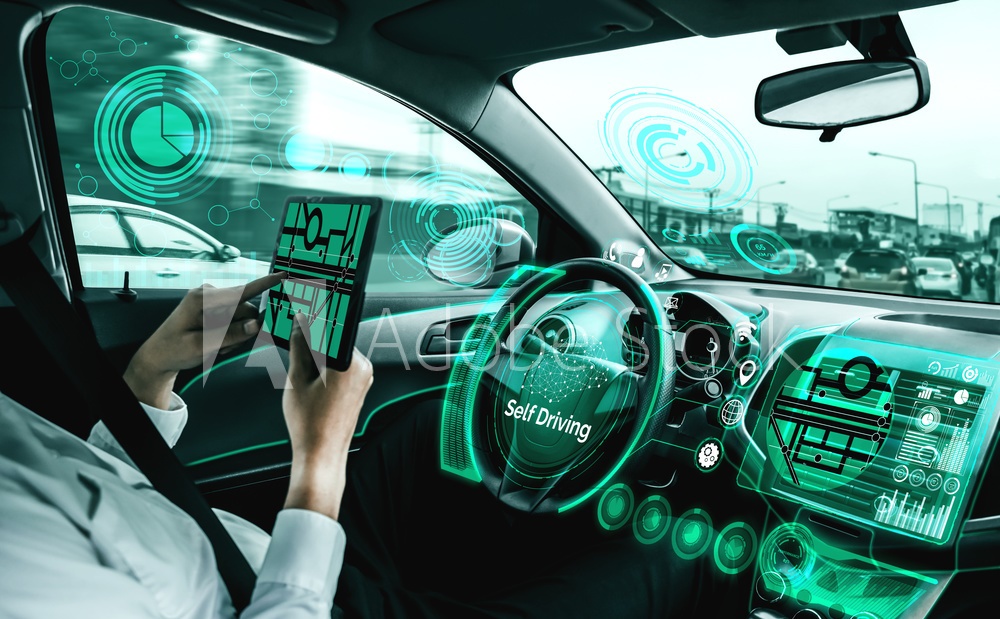
This blog post will discuss the emerging business opportunities specific to EV smart navigation system software. Navigation systems with the help of digital technologies such as AI, ML, AR and VR can guide the EV user on routes based on the real-time urban traffic data and can also help in collecting data for realistic 3D mapping of the surroundings for better use.
Digital Opportunities in Electric Vehicles – EVIT


 Our specialty focus areas include
Summary
- In-car 3D generated navigation systems for better visual of the surroundings with the help of sensors and imaging technology.
- Lidar technology for advanced imaging and sensing and mainly for road safety.
- A Google-based navigation system that plans efficient Ev routing based on the availability of charging infrastructure.
- Navigation system designed to find the optimal route in dense urban populations using satellite imaging technology.
Here are some prominent digital solutions and software used for electric vehicle navigation.
- In-car navigation system – XPeng Inc., a leading Chinese smart electric vehicle (“Smart EV”) company, announced that it will be the world’s first automaker to deploy A Map’s 3rd-generation in-car navigation system. The XPeng P7 smart EV sedan will be the first mass-production vehicle to use a Surrounding Reality (SR) display for navigation assisted autonomous driving.
- Automotive grade LIDAR technology – Xpeng Inc., a leading Chinese smart electric vehicle (“Smart EV”) company, has collaborated with Livox, a leading LIDAR maker, to deploy its automotive-grade LIDAR technology in Xpeng’s new production model in 2021. Livox is Xpeng’s first partner in LIDAR technology. Livox has customized its Horiz sensor (the automotive-grade version of its Livox Horizon) for Xpeng, not only meeting automotive-grade requirements but also delivering cost efficiency and reliability for production models. The implementation of LIDAR in XPILOT architecture – Xpeng’s autonomous driving system – will further enhance XPILOT’s safety as well as the ability to cover a comprehensive range of driving scenarios.
- Use of Google software in electric cars – Electric cars using Google software, like the Polestar 2 and Volvo XC40 Recharge, will feature an updated navigation system from Google Maps to help you plan to charge stops too. It’s known as EV route planning, and it will help you find the most efficient route. It calculates where you should stop along the way to recharge based on your battery range when you’re planning the trip — and also how much time you’ll have to spend at the charging station. It also considers what type of charger you’ll use (fast or regular, which is known as Level 2) and charger availability.
- Searching for nearest charging stations using iSmart – The iSmart 2.0 comes pre-installed on the company’s electric vehicle, the MG ZS EV. Here’s a quick glance at its features and how it performs out in the real world. MG has equipped the ZS EV with an 8-inch HD infotainment system and it has named it the iSmart 2.0. The infotainment system comes with a new 6-core processor paired with 3GB of RAM. The powerful internals ensures a smooth user experience. To make the experience even more delightful, the company has worked on the advanced interface. Furthermore, the iSmart 2.0 comes with an embedded SIM, which offers internet connectivity on the go. It offers accurate directions and an easy to navigate interface. Even if the car’s battery level is above 30 percent, users can still search for the nearest charging stations using the iSmart 2.0.
- Precision navigation from HERE – Focus on better navigation through dense and complex urban environments, getting smarter guidance for electric vehicle journeys, and tapping an until-now siloed wealth of location data that could upend logistics and autonomous vehicle development. HERE says it used LIDAR, optical imagery, and satellite data to build the maps, the result being incredible levels of detail: down to not only individual buildings but things like entry points to those structures. The data set also contains precise dimensions and other metadata like elevation and even the colors of the façades.
- Chargetrip provides routing technology for electric vehicles and comes with a need to reduce range anxiety. The navigation should provide an optimum path with amenities such as charging and precise mapping based on the driving range available for the vehicle depending on its characteristics, manufacturer, usage, and many other parameters. Chargetrip’s navigation engine evaluates such factors to provide safe routes for. They take into account the outside temperature, weather, charge speed, elevation, rolling resistance, real-time vehicle data, and congestion at charge stations. The company allows EV users to build queries, mention their vehicles, find suitable charging stations, etc with their API(software). Charge trip also develops web and mobile applications for various purposes as required by the customer company.
This is a part of the EV Digital Opportunities series
Posts in the series
- EVs and Big Data, Analytics, Customized learning
- EV and IoT / Cloud Solutions, Sensors, Connectivity, Database
- EV and AI / ML, Robotics, Customised learning
- EV mobile software applications, Payment gateways, Shared network
- EV and VR/AR solutions, Multimedia, Image processing
- EV fleet management software, Payment apps, Analytics software
- EV BMS software, PCB, PLC, Hardware circuits
- EV navigation systems software, Multimedia, Satellite communication, Image processing
- EV testing, design and simulation software, Programming, Framework
- EV charging software, Payment gateways, PCB, POS, Hardware circuits, Robotics
- EV Processes automation Softwares, ERP, Robotics
Keywords: In-car Navigation system, LiDAR tech, Sonar, Route optimization, 3D imaging, satellite imaging, i smart 2.0 processor chipset
==